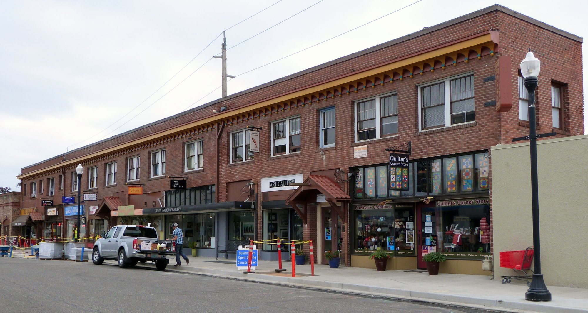
The Fisher-Rossi Building on Southwest Broadway Street in Beaverton (2015-08-14 10:38:07)

Outdoors

Hiking near Beaverton

National forests, parks, lakes and recreation areas with hiking trails near Beaverton, closest first.

23places to hike
7 mito the closest
3within 30 miles
Year-roundbest months

Good to know: Carry more water than you think you need, check the managing agency’s page for trail closures and fire restrictions, and start early on hot days.

Closest picks

1

Tualatin River National Wildlife Refuge

7 mi south · Fish and Wildlife Service

After increased agricultural development in the Tualatin River valley, many local residents in the late 1980s recognized the importance of conserving green space for future generations.

2

Henry Hagg Lake

20 mi west · Bureau of Reclamation

Henry Hagg Lake was formed by the construction of Scoggins Dam which is a major facility of the Tualatin Project . The lake has a capacity of nearly 60,000 acre-feet of water and a surface area of 1,113 acres.

3

Sandy Wild and Scenic River

25 mi east · Bureau of Land Management

The Sandy River originates in the high glaciers of Mt. Hood, the most prominent peak in Oregon's Cascade Mountains.

Map of all 23 places

Map of 23 places loads as you scroll.

Within 30 miles (3)

7 mi south · Fish and Wildlife Service

Tualatin River National Wildlife Refuge

After increased agricultural development in the Tualatin River valley, many local residents in the late 1980s recognized the importance of conserving green space for future generations.

  • Birding
  • Educational Programs
  • Hiking
  • Hunting
  • Photography
  • Wildlife viewing

20 mi west · Bureau of Reclamation

Henry Hagg Lake

Henry Hagg Lake was formed by the construction of Scoggins Dam which is a major facility of the Tualatin Project . The lake has a capacity of nearly 60,000 acre-feet of water and a surface area of 1,113 acres.

  • Biking
  • Boating
  • Fishing
  • Hiking
  • Picnicking
  • Water sports
  • Wildlife viewing

25 mi east · Bureau of Land Management

Sandy Wild and Scenic River

The Sandy River originates in the high glaciers of Mt. Hood, the most prominent peak in Oregon's Cascade Mountains.

  • Biking
  • Camping
  • Fishing
  • Hiking
  • Nature education

30 to 75 miles (20)

32 mi southeast · Bureau of Land Management

Molalla

Enjoy a scenic drive along the Molalla River, which offers easy river access and opportunities for picnicking, swimming, camping, whitewater boating and fishing.

  • Camping
  • Fishing
  • Hiking
  • Photography
  • Picnicking
  • Swimming

34 mi southeast · Bureau of Land Management · Campground

Three Bears Campground

No cash, check, or cards are accepted on site. Make a reservations online or use the mobile app. Three Bears campsites are only available by making a reservation.

  • Biking
  • Camping
  • Fishing
  • Hiking
  • Photography
  • Swimming
  • Wildlife viewing

35 mi southeast · Bureau of Land Management

Clackamas Wild and Scenic River

The Clackamas River is located to the west of the Cascade Range and to the south of the Columbia River Gorge in northern Oregon.

  • Accessible Facility Or Activity
  • Biking
  • Fishing
  • Hiking

35 mi southeast · Bureau of Land Management

South Fork Clackamas Wild and Scenic River

The South Fork of the Clackamas River is a tributary of the Clackamas River on the western slope of the Cascade Range in northwest Oregon.

  • Fishing
  • Hiking
  • History
  • Photography
  • Wildlife viewing

36 mi northeast · USDA Forest Service · Campground

Sunset Falls Campground

Sunset Campground is located in the Gifford Pinchot National Forest. Visitors enjoy scenic views of the river and a waterfall within the campground. The campground is open all year.

  • Boating
  • Camping
  • Hiking

38 mi southeast · Bureau of Land Management · Campground

Aquila Vista Recreation Site

Aquila Vista is available for overnight group camping for groups up to 20 people and 8 vehicles. The opening date for 2026 is June 26.

  • Biking
  • Camping
  • Hiking
  • Horseback riding
  • Photography
  • Wildlife viewing

38 mi west · Bureau of Land Management

Nestucca River Recreation Area

Want to go camping? Camping season is generally May-October. Reserve a site at one of our four campgrounds on recreation.gov or pay when you arrive for non-reserved campsites using the Recreation.gov Mobile App .

  • Biking
  • Boating
  • Camping
  • Climbing
  • Fishing
  • Hiking
  • Paddling
  • Photography

39 mi southeast · USDA Forest Service · Campground

Armstrong

Armstrong Campground is a small but beautiful place to camp, right on the edge of the Clackamas Wild and Scenic River.

  • Biking
  • Boating
  • Camping
  • Fishing
  • Hiking
  • Water sports
  • Wildlife viewing

41 mi east · Bureau of Land Management · Campground

Wildwood Recreation Site

Wildwood Recreation Site is open year-round but may close due to vehicle access during severe weather. Check status during severe weather events by calling 503-375-5646.

  • Backpacking
  • Berry Picking
  • Biking
  • Birding
  • Camping
  • Fish Viewing Site
  • Fishing
  • Hiking

42 mi southwest · Fish and Wildlife Service

Baskett Slough National Wildlife Refuge

Located outside the City of Dallas, just off of Highway 99 and Highway 22, Baskett Slough offers unique wildlife viewing opportunities for the whole family!

  • Birding
  • Hiking
  • Hunting
  • Photography
  • Ranger programs
  • Wildlife viewing

42 mi southwest · USDA Forest Service · Campground

Rocky Bend Group Campground

Nestled on the banks of the Nestucca River, Rocky Bend Group Campground is ideal for family gatherings and group events. The site is located on Upper Nestucca River Road 16 miles east of Beaver, Oregon.

  • Biking
  • Camping
  • Fishing
  • Hiking
  • Water Access

42 mi southeast · Bureau of Land Management

Table Rock Wilderness

The United States Congress designated the Table Rock Wilderness in 1984 and it now has over 5,786 acres. All of this wilderness is located in Oregon and is managed by the Bureau of Land Management.

  • Hiking
  • Wilderness
  • Wildlife viewing

44 mi east · US Army Corps of Engineers

Bonneville Lock and Dam

Located in the Columbia Gorge National Scenic Area 40 miles east of Portland, Oregon, and Vancouver, Washington, Bonneville Lock and Dam spans the Columbia and links the two states. The U.S.

  • Boating
  • Hiking
  • History
  • Nature education
  • Picnicking
  • Water sports
  • Wildlife viewing

49 mi south · Fish and Wildlife Service

Ankeny National Wildlife Refuge

Located near the confluence of the Santiam and Willamette Rivers, just off of Interstate 5, Ankeny offers unique wildlife viewing opportunities for the whole family!

  • Birding
  • Educational Programs
  • Hiking
  • Photography
  • Wildlife viewing

50 mi southeast · Bureau of Land Management

Elkhorn Creek Wild and Scenic River

Elkhorn Creek is a unique, pristine, low-elevation setting, with limited access, providing a landscape with few signs of human disturbance or activity.

  • Accessible Facility Or Activity
  • Fishing
  • Hiking

54 mi northeast · USDA Forest Service

Gifford Pinchot National Forest

.

  • Biking
  • Boating
  • Camping
  • Fire Lookouts/Cabins Overnight
  • Fishing
  • Hiking
  • Horse Camping
  • Horseback riding

54 mi east · USDA Forest Service

Mt. Hood National Forest

  • Biking
  • Boating
  • Camping
  • Climbing
  • Fire Lookouts/Cabins Overnight
  • Fishing
  • Hiking
  • Horse Camping

56 mi west · Fish and Wildlife Service

Cape Meares National Wildlife Refuge

Old-growth forest surrounded by a tumultuous ocean set the primeval scene at Cape Meares. Its cliffs support five species of nesting seabirds and a pair of Peregrine Falcons, a species recovered from the brink of extinction.

  • Birding
  • Hiking
  • Observation Site
  • Photography
  • Wildlife viewing

58 mi east · Bureau of Reclamation

Clear Lake

Clear Lake is formed by Wasco Dam which is a major facility of the Wapinitia Project . The 557-acre reservoir is located in the Cascade Mountains in Oregon. The lake is about 13 miles south of Mt. Hood and lies in a small forested valley.

  • Boating
  • Camping
  • Fishing
  • Hiking
  • Nature education
  • Picnicking
  • Ranger programs
  • Recreational Vehicles

58 mi southwest · Bureau of Land Management

Valley of the Giants Outstanding Natural Area

Some of the largest Douglas firs and Western Hemlocks in the Oregon Coast Range can be found in the Bureau of Land Management’s Valley of the Giants.

  • Backpacking
  • Bird Watching
  • Hiking
  • Photography
  • Wildlife viewing

Distances are straight-line miles from downtown Beaverton. Listings come from Recreation.gov’s federal recreation database; check each official page for hours, fees, fire restrictions and closures before you go.

Get outside around Beaverton

Forest Walk in Tualatin Hills Nature Park video thumbnail

THINGS TO DO · YOUTUBE SHORT

Forest Walk in Tualatin Hills Nature Park

A late-winter morning walk along the forest trails of Tualatin Hills Nature Park. A film shared by And This Walk Too.

Watch on YouTube ↗
Beaverton, Oregon (Old Town, Parks) 4k60 Walking Tour Binaural Audio video thumbnail

A WALK AROUND TOWN

Beaverton, Oregon (Old Town, Parks) 4k60 Walking Tour Binaural Audio

Beaverton, Oregon (Old Town, Parks) 4k60 Walking Tour Binaural Audio. A film shared by 4K Nature and City Walks.

Watch on YouTube ↗

More outdoors near Beaverton

Questions

Where is the closest place for hiking near Beaverton?

Tualatin River National Wildlife Refuge (Fish and Wildlife Service), about 7 miles south of Beaverton as the crow flies. Next are Henry Hagg Lake (20 mi) and Sandy Wild and Scenic River (25 mi).

When is the best time for hiking near Beaverton?

Based on Beaverton’s average highs, all year. Conditions at higher elevations can be much cooler.

Who manages these places?

Federal agencies including Bureau of Land Management, USDA Forest Service, Fish and Wildlife Service. Each listing links to its official page for hours, fees, closures and current conditions.

Beaverton AI

Your Beaverton local guide
Hey there!

I'm Beaverton AI. Ask about neighborhood food, independent shops, local history or planning a visit.

AI recommendations may be inaccurate. Verify hours and prices. Questions are processed by Cloudflare. Privacy