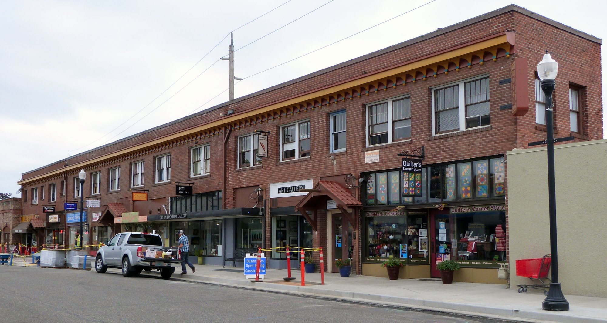
The Fisher-Rossi Building on Southwest Broadway Street in Beaverton (2015-08-14 10:38:07)

Outdoors

Picnic spots near Beaverton

Day-use and picnic areas near Beaverton on public land, from quick drives to full-day outings.

11picnic areas
20 mito the closest
1within 30 miles
April–Octoberbest months

Good to know: Group picnic sites can often be reserved; fire rules change with the season, so check before bringing a grill.

Closest picks

1

Henry Hagg Lake

20 mi west · Bureau of Reclamation

Henry Hagg Lake was formed by the construction of Scoggins Dam which is a major facility of the Tualatin Project . The lake has a capacity of nearly 60,000 acre-feet of water and a surface area of 1,113 acres.

2

Molalla

32 mi southeast · Bureau of Land Management

Enjoy a scenic drive along the Molalla River, which offers easy river access and opportunities for picnicking, swimming, camping, whitewater boating and fishing.

3

Dovre Recreation Site

34 mi west · Bureau of Land Management

Want to camp? Camping season is generally May-September, with Alder Glen and Elk Bend remaining open through the weekend following General Western Oregon Coast 2nd Season for elk.

Map of all 11 places

Map of 11 places loads as you scroll.

Within 30 miles (1)

20 mi west · Bureau of Reclamation

Henry Hagg Lake

Henry Hagg Lake was formed by the construction of Scoggins Dam which is a major facility of the Tualatin Project . The lake has a capacity of nearly 60,000 acre-feet of water and a surface area of 1,113 acres.

  • Biking
  • Boating
  • Fishing
  • Hiking
  • Picnicking
  • Water sports
  • Wildlife viewing

30 to 75 miles (10)

32 mi southeast · Bureau of Land Management

Molalla

Enjoy a scenic drive along the Molalla River, which offers easy river access and opportunities for picnicking, swimming, camping, whitewater boating and fishing.

  • Camping
  • Fishing
  • Hiking
  • Photography
  • Picnicking
  • Swimming

34 mi west · Bureau of Land Management · Campground

Dovre Recreation Site

Want to camp? Camping season is generally May-September, with Alder Glen and Elk Bend remaining open through the weekend following General Western Oregon Coast 2nd Season for elk.

  • Camping
  • Fishing
  • Picnicking
  • Swimming
  • Wildlife viewing

38 mi west · Bureau of Land Management

Nestucca River Recreation Area

Want to go camping? Camping season is generally May-October. Reserve a site at one of our four campgrounds on recreation.gov or pay when you arrive for non-reserved campsites using the Recreation.gov Mobile App .

  • Biking
  • Boating
  • Camping
  • Climbing
  • Fishing
  • Hiking
  • Paddling
  • Photography

41 mi east · Bureau of Land Management · Campground

Wildwood Recreation Site

Wildwood Recreation Site is open year-round but may close due to vehicle access during severe weather. Check status during severe weather events by calling 503-375-5646.

  • Backpacking
  • Berry Picking
  • Biking
  • Birding
  • Camping
  • Fish Viewing Site
  • Fishing
  • Hiking

44 mi east · US Army Corps of Engineers

Bonneville Lock and Dam

Located in the Columbia Gorge National Scenic Area 40 miles east of Portland, Oregon, and Vancouver, Washington, Bonneville Lock and Dam spans the Columbia and links the two states. The U.S.

  • Boating
  • Hiking
  • History
  • Nature education
  • Picnicking
  • Water sports
  • Wildlife viewing

48 mi southeast · USDA Forest Service

Test Forest

Niloo testing 6/6/19 Niloo testing link to a not-classified page Jusin testing link to a non-classified page under recreation node Testing doc 20 acres of pristine forest. Niloo testing 12/17/18 Marty testing 8/20/19

  • Biking
  • Camping
  • Climbing
  • Fishing
  • Picnicking

52 mi south · Bureau of Land Management

Fishermen's Bend Recreation Area

Surrounded by the tranquility of the North Santiam River, Fishermen's Bend has something for everyone. This full-service campground offers hot showers, fire pits, picnic tables, and water and electricity hook-ups for RV's.

  • Boating
  • Camping
  • Fishing
  • Picnicking
  • Ranger programs

54 mi northeast · USDA Forest Service

Gifford Pinchot National Forest

.

  • Biking
  • Boating
  • Camping
  • Fire Lookouts/Cabins Overnight
  • Fishing
  • Hiking
  • Horse Camping
  • Horseback riding

54 mi east · USDA Forest Service

Mt. Hood National Forest

  • Biking
  • Boating
  • Camping
  • Climbing
  • Fire Lookouts/Cabins Overnight
  • Fishing
  • Hiking
  • Horse Camping

58 mi east · Bureau of Reclamation

Clear Lake

Clear Lake is formed by Wasco Dam which is a major facility of the Wapinitia Project . The 557-acre reservoir is located in the Cascade Mountains in Oregon. The lake is about 13 miles south of Mt. Hood and lies in a small forested valley.

  • Boating
  • Camping
  • Fishing
  • Hiking
  • Nature education
  • Picnicking
  • Ranger programs
  • Recreational Vehicles

Distances are straight-line miles from downtown Beaverton. Listings come from Recreation.gov’s federal recreation database; check each official page for hours, fees, fire restrictions and closures before you go.

Get outside around Beaverton

Forest Walk in Tualatin Hills Nature Park video thumbnail

THINGS TO DO · YOUTUBE SHORT

Forest Walk in Tualatin Hills Nature Park

A late-winter morning walk along the forest trails of Tualatin Hills Nature Park. A film shared by And This Walk Too.

Watch on YouTube ↗
Beaverton, Oregon (Old Town, Parks) 4k60 Walking Tour Binaural Audio video thumbnail

A WALK AROUND TOWN

Beaverton, Oregon (Old Town, Parks) 4k60 Walking Tour Binaural Audio

Beaverton, Oregon (Old Town, Parks) 4k60 Walking Tour Binaural Audio. A film shared by 4K Nature and City Walks.

Watch on YouTube ↗

More outdoors near Beaverton

Questions

Where is the closest place for picnic spots near Beaverton?

Henry Hagg Lake (Bureau of Reclamation), about 20 miles west of Beaverton as the crow flies. Next are Molalla (32 mi) and Dovre Recreation Site (34 mi).

When is the best time for picnic spots near Beaverton?

Based on Beaverton’s average highs, April–October. Conditions at higher elevations can be much cooler.

Who manages these places?

Federal agencies including Bureau of Land Management, USDA Forest Service, Bureau of Reclamation. Each listing links to its official page for hours, fees, closures and current conditions.

Beaverton AI

Your Beaverton local guide
Hey there!

I'm Beaverton AI. Ask about neighborhood food, independent shops, local history or planning a visit.

AI recommendations may be inaccurate. Verify hours and prices. Questions are processed by Cloudflare. Privacy